The recent strategic partnership between India's national mapping agency Survey of India, energy giant Indian Oil Corporation Limited (IOCL), and digital mapping pioneer MapmyIndia Mappls represents a significant evolution in how governments are leveraging geospatial intelligence for national development. However, this convergence also introduces complex cybersecurity challenges that could redefine national security paradigms in the IoT era.
This collaboration aims to create comprehensive digital mapping solutions that will power India's infrastructure development, urban planning, and energy distribution networks. The integration of Survey of India's authoritative mapping data with MapmyIndia's technological capabilities and IOCL's nationwide energy infrastructure creates an unprecedented IoT ecosystem that spans critical national assets.
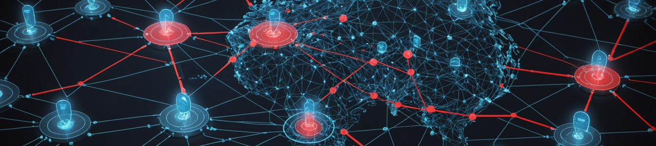
From a cybersecurity perspective, this partnership establishes multiple new attack vectors. The interconnected nature of these systems means that a vulnerability in one component could potentially compromise the entire network. Security researchers have identified several critical areas of concern:
Geospatial Data Integrity: The accuracy and reliability of digital maps are paramount for national security and infrastructure planning. Any manipulation of this data could lead to catastrophic failures in urban development, emergency response, and resource allocation. Attackers targeting these systems could subtly alter mapping data to cause long-term infrastructure problems or immediate crisis situations.
IoT Infrastructure Vulnerabilities: The integration of IoT devices across energy distribution networks, transportation systems, and urban infrastructure creates numerous entry points for cyber attackers. Each connected device represents a potential vulnerability that could be exploited to gain access to sensitive systems or disrupt critical services.
Data Privacy and Sovereignty: The collection and processing of detailed geospatial data raise significant privacy concerns. This information, when combined with IoT sensor data, can create comprehensive profiles of citizen movements, behaviors, and activities. Ensuring this data remains secure and sovereign is crucial for national security.
Supply Chain Security: The partnership involves multiple organizations with different security postures and protocols. This complexity increases the risk of supply chain attacks, where vulnerabilities in one organization's systems could be leveraged to compromise the entire ecosystem.
The convergence of geospatial intelligence with IoT infrastructure represents a global trend that cybersecurity professionals must address urgently. Similar initiatives are emerging worldwide as governments recognize the strategic importance of digital mapping for economic development and national security.
Security recommendations for such integrated systems include implementing zero-trust architectures, conducting regular security audits of all connected components, establishing robust encryption protocols for data in transit and at rest, and developing comprehensive incident response plans that account for the interconnected nature of these systems.
As nations continue to digitize their critical infrastructure and integrate geospatial intelligence with IoT networks, the cybersecurity community must develop specialized expertise in protecting these complex, interconnected systems. The stakes are particularly high when national security assets and critical infrastructure are involved, requiring collaboration between government agencies, private sector partners, and cybersecurity experts to establish effective security frameworks.
The MapmyIndia-Survey of India-IOCL partnership serves as a case study for other nations embarking on similar digital transformation journeys. It highlights both the tremendous potential of integrated geospatial-IoT systems and the significant security challenges that must be addressed to ensure these systems enhance rather than compromise national security.
Comentarios 0
Comentando como:
¡Únete a la conversación!
Sé el primero en compartir tu opinión sobre este artículo.
¡Inicia la conversación!
Sé el primero en comentar este artículo.